DESEASION is a powerful decision support tool designed specifically for help maritime decision and assessment tasks. It offers a range of innovative features and functionalities to help users make informed decisions and evaluate different options.
With DESEASION, users can easily visualize and analyze various spatial data layers, including environmental, socio-economic, and other relevant factors, to support decision-making processes.
DESEASION is designed to be user-friendly and intuitive, allowing planners, stakeholders, and decision-makers to easily collaborate and share information throughout the decision and assessment process. Whether you're involved in coastal development, offshore wind farm planning, or any other type of maritime spatial planning and assessment, DESEASION can help you make better-informed decisions and ensure sustainable development of the ocean.
Features
Modelling
- Hierarchical structuring of the decision problem
- Accurate modelling of the multiple criteria involved in the decision
- Integration of the perspectives of the multiple stakeholders
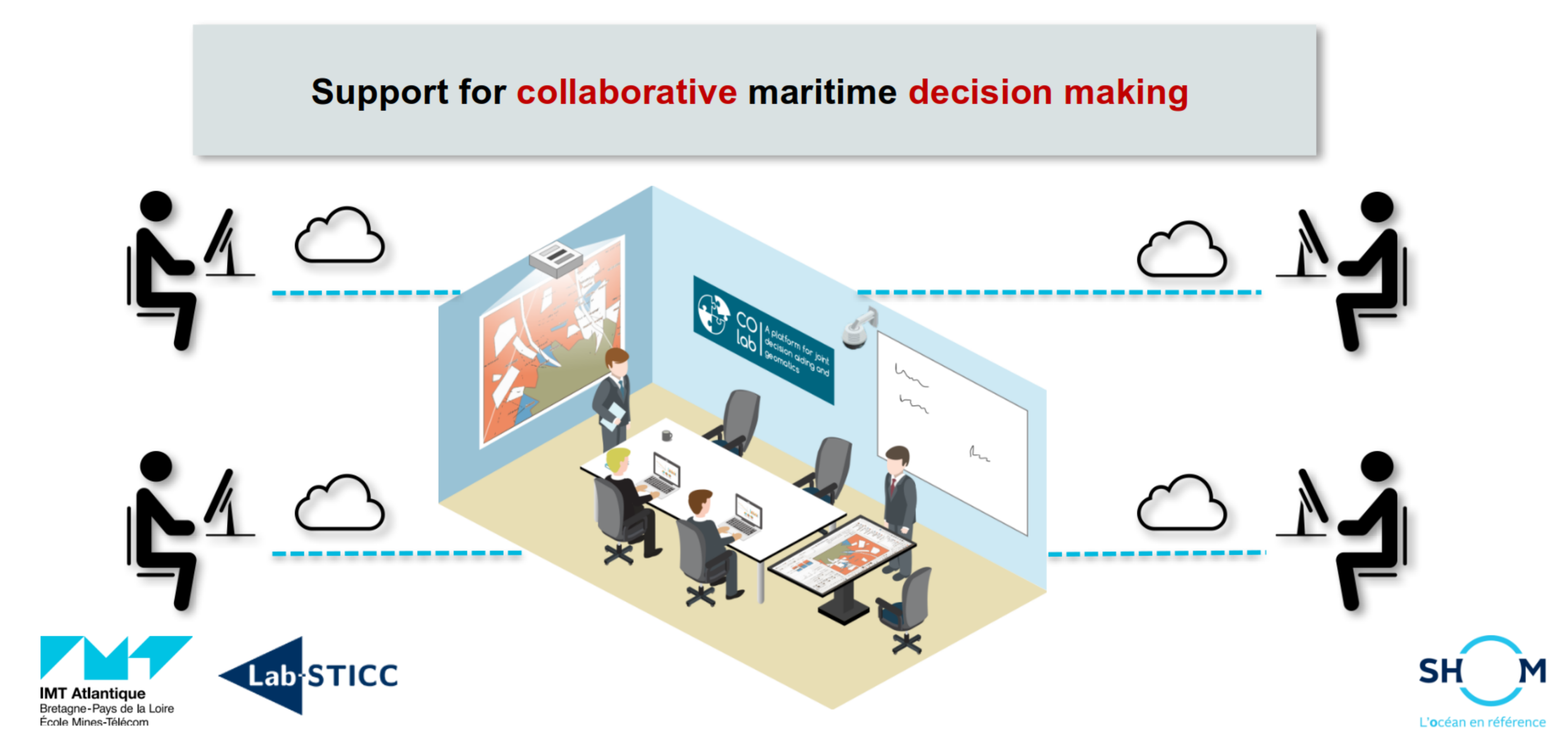
- Distant or local collaboration around a unique tool
Evaluation
- Qualitative or quantitative evaluation of the geographical zones, based on the multiple criteria involved in the decision problem
- Integration of the human perspective in this evaluation
- Taking into account of the preferences of the multiple stakeholders
- Use of various evaluation models
Planning
- Taking into account of complex constraints of the stakeholders
- Automatic generation of recommendations of zones
- Comparative study of multiple zones
- Human readable explanations of recommendations
Decision making
- Traceability and justification of the decision recommendation
- Search for a compromise solution satisfying the actors of the decision problem
Possible usage: multiple stakeholders interact locally of from distance on the same decision or assessment problem
Use cases
- Maritime spatial planning (MSP)
- Impact assessment on ecological ecosystems
- Determination of protected marine areas
- Location of offshore wind turbines
- Controled ship stranding
- Development of maritime areas or the coast
- ...
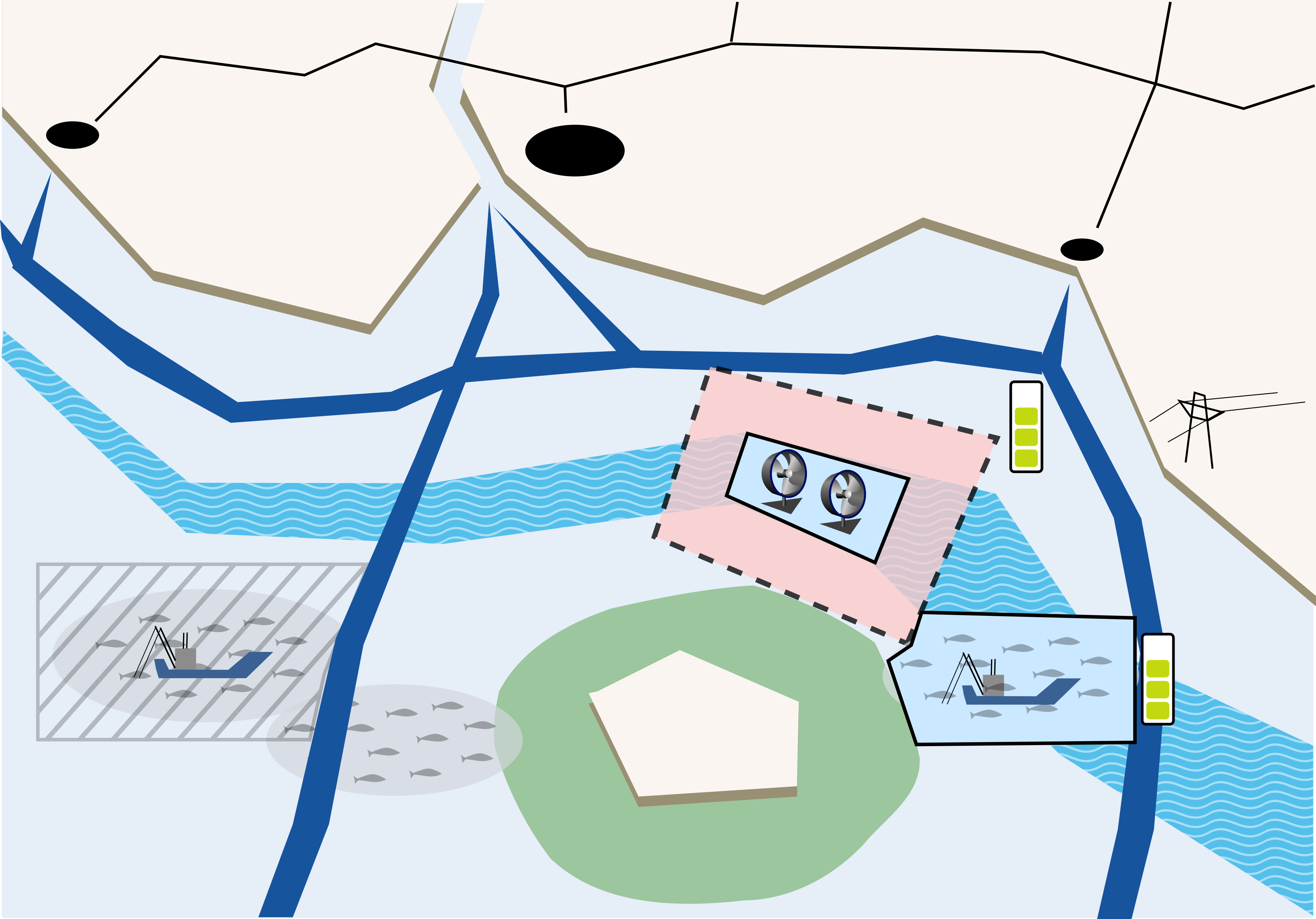
Possible usecase: locating a fishing zone and an underwater turbine zone simultaneously, constrained by various other human activities
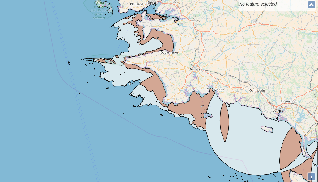
Screenshot
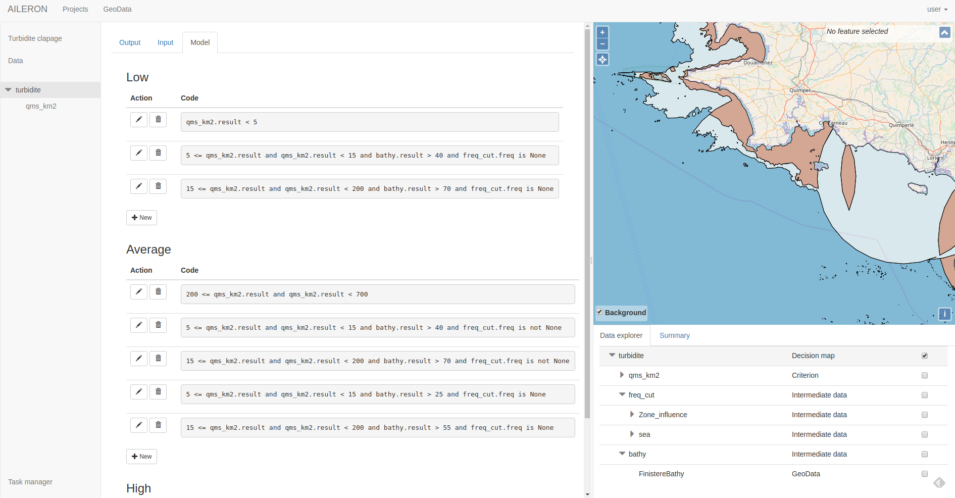 Screenshot of the actual decision support platform DESEASION.
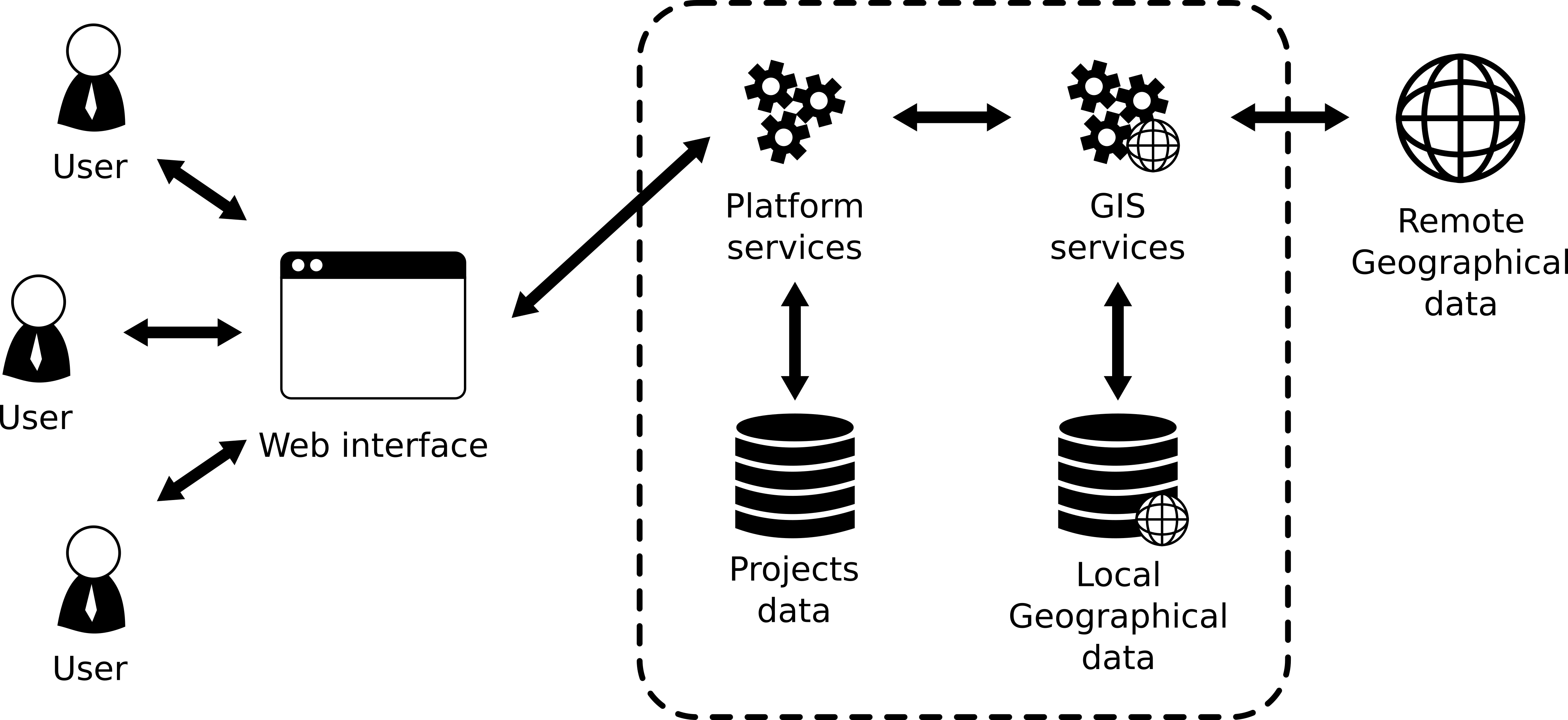
Architecture
High level schema of DESEASION's architecture, which allows for various modes of colaboration
Download
The source code and installation guide can be found here.
Institutional support
The DESEASION tool is developped in the context of collaborative scientific projects between the French National Hydrographic Service (SHOM), IMT Atlantique, and the Lab-STICC CNRS laboratory.